The Great R'Idaho Trail #1
Nevada to Canada - Route DescriptionStage 1: Jarbidge to Pine
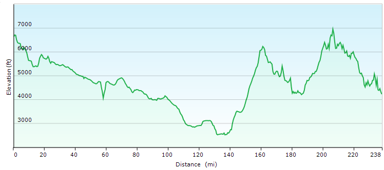
Distance in Miles
Miles of Trail
Minimum Elevation in Ft
Max Elevation
Interactive Maps To See Detailed Route. (Full Screen) Download GRIT1-N2C Tracks
Legend
- Navy Blue: Designated motorcycle trails or notably tougher ATV trails
- Green: Designated ATV trails or just too easy motorcycle trails
- Magenta: Roads. Dirt Road most often, but occasionally paved.
- Light Blue: Easier Bypass Detours or optional side-trips. Only the first section of a detour is color coded when the route splits.
- Black: Special Test Detours. Only the first section of a detour is color coded when the route splits.
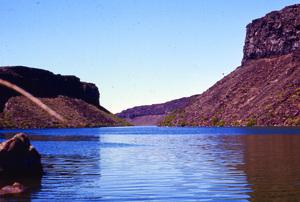
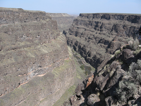 Double check that your gear, tire pressure and GPS are ready to roll and get on the road as you head north. This is the day of high desert canyon lands exploration so start extra early, carry extra water and sunscreen for your exposed skin. Since it is probably extra hot, we have given you the fastest route through the desert, with a detour to the breathtaking Bruneau Canyon with its natural hot springs and collapsing bridge. The detour is also a chance to cool off in the Bruneau river before your climb back up the steep rocky jeep trail. A bypass for this is detour is provided in pale blue if it is just too hot to enjoy and you want to stay on the dirt highway. The “special test” route in black closely follows the Idaho Centennial Trail which can be fun, but slower and riddled with lava rock. It is not advanced if you want to do this, but it is a long first day. All options pass near a rock cabin that is worth the short detour off the main route to check this glimpse into the old west past.
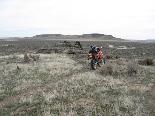 This desert a mystical part of the country referred to as the big quiet. The last and largest undeveloped section of desert in the Continental US. It’s a place where you can look across the huge horizon and not see any sign of inhabitants, feeling like you are on the road to nowhere. This includes aircraft, one of the biggest holes in official flight paths in the lower 48 states.
 After the high desert we go though some farm land and pass by the CJ Strike Wildlife Management Area along the Snake River on our way to Glenn’s Ferry for a chance to gas up, drink fluids and eat. But don’t linger too long because we are about to find the scenic route out of civilization to ride the shores of the Anderson Ranch Reservoir and get to 25 miles of mountain trails before spending the night in Pine, ID or Featherville. Pine has more facilities and supplies, and Featherville gas is only available when the owner is there so call first if you plan to sleep, eat and gas-up there. All phone numbers are in the GPX files in the waypoint details.