The Great R'Idaho Trail #1
Nevada to Canada - Route DescriptionStage 1: Jackpot to Pine
Distance in Miles
Miles of Trail
Minimum Elevation in Ft
Max Elevation
Interactive Maps To See Detailed Route. (Full Screen) Download GRIT1-N2C Tracks
Legend
- Red: Designated motorcycle trails with Most Difficult/Advanced rating.
- Navy Blue: Designated motorcycle trails or notably tougher ATV trails
- Green: Designated ATV trails or just too easy motorcycle trails
- Magenta: Roads. Dirt Road most often, but occasionally paved.
- Light Blue: Easier Bypass Detours or optional side-trips. Only the first section of a detour is color coded when the route splits.
- Black: Special Test Detours. Only the first section of a detour is color coded when the route splits.
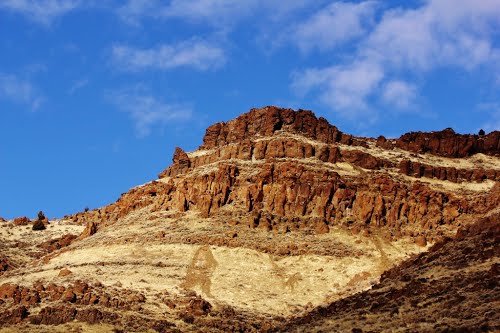 This is a mild day for trail difficulty, but just a plain fun combination of scenic jeep trails and single track with a few sections of pavement to get across the rural farm areas. It starts from the easy access Jackpot, NV, just one hour south on Hwy 93 from the full services at Twin Falls, ID.
You get right off the pavement on your way out of town to take some cool scenic jeep roads and warm up the riding skills. It won’t be long when you are starting your first mountain trail that are 30 miles of easy to moderate trails with several picture worthy points along the way. There is one special test along the way. It is short, but has a couple extreme obstacles so it should be left for experts or aggressive teams that can work together. The rest of the day is casual, but fun ADV style riding using cattle rancher jeep roads/trails to cross the wide desert of southern Idaho to land in Pine for the night. The jeep trails may not be the most difficult, but they have already scored their fair share of rider injuries, so don’t get too much into baja racer mode. You have a long week ahead and stage one is probably the easiest stage of the route.