The Great R'Idaho Trail #1
Nevada to Canada - Route Description
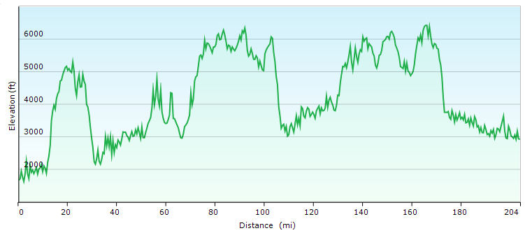
Stage 5: Pierce to Avery
Distance in Miles
Miles of Trail
Minimum Elevation in Ft
Maximum Elevation in Ft
Interactive Maps To See Detailed Route. (Full Screen) Download GRIT1-N2C Tracks Legend
- Red: Advanced Designated motorcycle trails
- Navy Blue: Designated motorcycle trails or notably tougher ATV trails
- Green: Designated ATV trails or just too easy motorcycle trails
- Magenta: Roads. Dirt Road most often, but occasionally paved.
- Light Blue: Easier Bypass Detours or optional side-trips. Only the first section of a detour is color coded when the route splits.
- Black: Special Test Detours. Only the first section of a detour is color coded when the route splits.
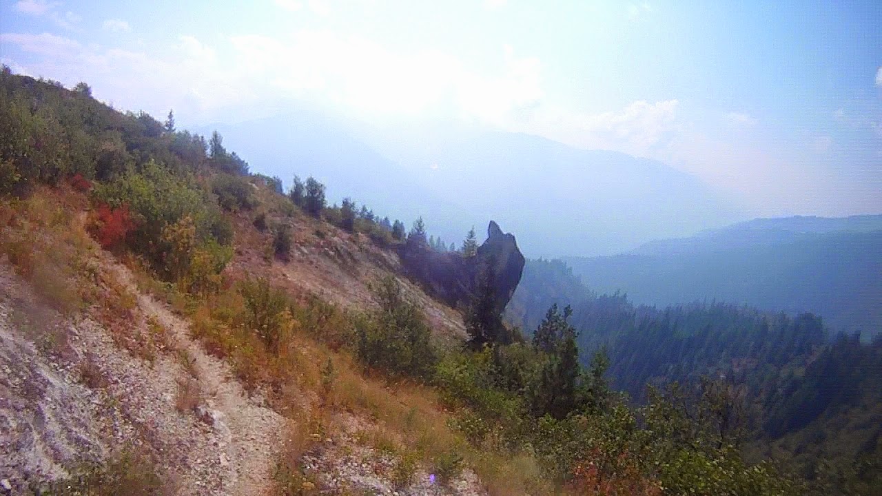 This section is the longest for gas range required at 189 miles with a high volume of trails, so pack what you need and start early. Once out of town, we climb some windy jeep roads and continue the climb up Dan Lee Ridge trail until we get to Hemlock Butte Lookout. From here we have to decide if we can take on the very narrow side hills of the Larch Butte trail, because this is where the bypass starts if you want to wave off.
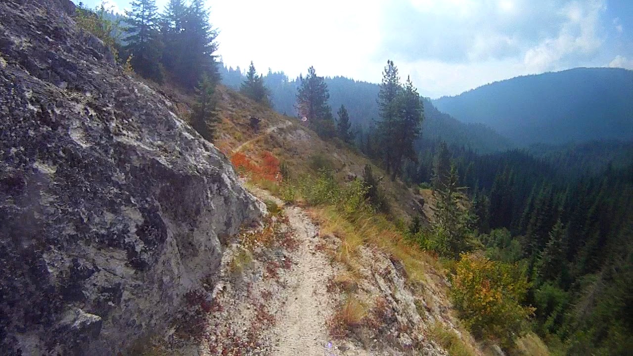
Both options bring us to the Weitas Guard Station where you have 3 options. If you want the toughest trails, head north over Cabin Pt and Pot Mountain Ridge trails and special test credit. If you aren’t ready for all the standard trails, head North on Weitas to the road to bypass a chunk of the trails ahead. The main route goes south past the ranger station and onto the longest continuous trail segment of the expedition for 52 miles of single track, starting with 21 miles of Weitas Creek Trail that ends at 12 mile saddle.

Junction Mt LO
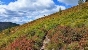
From 12 mile saddle, we have another flowing 29 mile section of single track that starts out as Windy Ridge. It is a jammin’ trail that is fairly easy even though it is riddled with water run-off humps for kickers. Then the nominal track turns right when it intersects Windy Bill trail. At the Windy Bill turn, slower riders can decide to continue north on Windy ridge for a shorter and easier option that is also very scenic as it goes over Cook Mt. But this option is only legally open after August 1st. Whereas Windy Bill is always open, and gets more skinny and windy, taking us across hill sides that are often covered with Huckleberries in late August or September. Half way down Windy Bill, there is a special test split option. If you are riding here prior to August 1st, then you legally must take the special test option and continue along the Windy Bill trail, then across Scurvy Mt trail. This adds a few more miles so plan gas accordingly. If you are after August 1st, then you head up the main route on Junction Mt trail. The Junction Mt trail then descends rapidly with switchbacks to end at a lush fern gully stream bridge, just before emerging to a larger bridge crossing Kelly Creek that takes us out to the main road.
Cook Mt Trail Option
We cruise about 60 miles of fast forest roads, enjoying river views and campsites as we climb Birch Hill before crossing the divide and dropping into St. Joe River country and then finally arriving at the Montana state line and the next trail. From here we follow the ridge line on the State Line National Recreation Trail with jaw dropping views. If you have ridden this trail before, the alternative is also great. You make your way to the Simmons Tower and take the short spur to the tower for a picture of the gorgeous views. Then drop back down to take Simmons Ridge ST trail over Simmons Peak on a tough 8 miles. Simmons Ridge trail has a few advanced spots. But the extra lake views from the top and the sense of accomplishment are worth it if you can. The descent down the other side is a brake slide affair as well. We do not recommend this trail if you are doing the route in the opposite North-to-South direction…take the state line trail to avoid tearing up the Simmons Peak trail. After either option, we cruise fast dirt and paved roads along the scenic St Joe River to get into Avery for Gas, food and lodging in a town with a population of only 25, but active in summer.