The Great R'Idaho Trail #1
Nevada to Canada - Route Description
Stage 7: Gold Creek Lodge to Canada
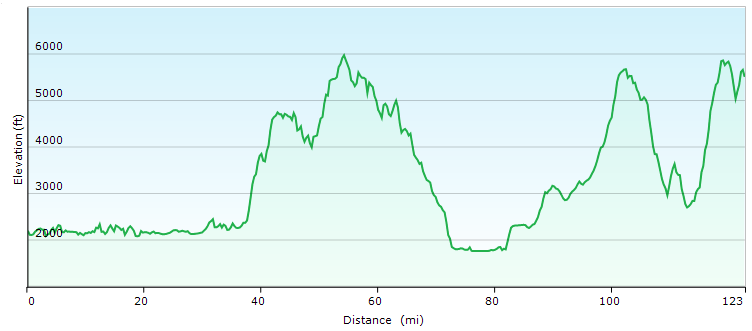
Distance in Miles
Miles of Trail
Minimum Elevation in Ft
Maximum Elevation in Ft
Interactive Maps To See Detailed Route.
(Full Screen) Download GRIT1-N2C Tracks
Legend
- Red: Designated motorcycle trails with Most Difficult/Advanced rating.
- Navy Blue: Designated motorcycle trails or notably tougher ATV trails
- Green: Designated ATV trails or just too easy motorcycle trails
- Magenta: Roads. Dirt Road most often, but occasionally paved.
- Light Blue: Easier Bypass Detours or optional side-trips. Only the first section of a detour is color coded when the route splits.
- Black: Special Test Detours. Only the first section of a detour is color coded when the route splits.
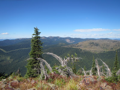
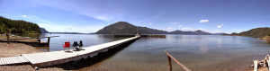 We leave Lakeview and quickly get to the turn-off up Gold Creek ATV trail. We soon pass thru a mystical grove of Cedar and up the rugged valley single track for 4 miles. At the top, expert riders have to chance to take on the PackSaddle trail special test for a workout. For a more moderate special test, you can take short connector roads to get to a fairly difficult trail called Larch Mountain, highlighted by some windy power climbs and views that takes you up to 5300ft before it drops you down to the river at 3400ft. All options continue north to the trail head of a treasure special test trail spur up to the top of Green Monarch Trail for awesome Pend Oreille Lake views, possibly near sunset. Green Monarch trail does have a couple tough spots so you get the satisfaction of earning that reward.
 We descend down roads forest into the small town of Clark Fork. This next section is a reminder of why we must all be activists and volunteers to fight to keep our trails open. All the trails, and even the thru dirt roads between Clark fork and Moyie Springs/Bonners Ferry have been closed to motor vehicles. Even the sweet Idaho Centennial trail is closed to us. So a chunk of today’s route is more of an ADV route, similar to the IDBDR that comes thru here as well. But the faster travel means we can readily finish and still have time to get back from the border to our motel or shuttle truck in daylight. Don’t fret though, we finish today in classic R’Idaho style with some rugged single track and multiple options to touch Canada for your photo finish in your own way… in the forest or at the government border crossing. So let’s do this!
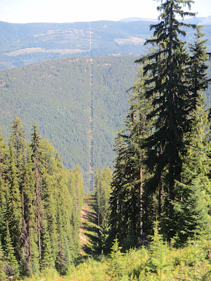
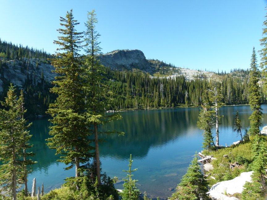 Get ready to sit back and get into Zen and the Art of Motorcycle Trekking. Head out of Clark Fork along Hwy 200 for 4 miles. Try not to miss the turn off to Denton road for a more relaxing and local flavor frontage road for 7 miles. Then it will drop back onto Hwy 200 for 3 miles to get to our turn off at Lower Pack River road. Follow the combination of local country roads so we can head up the dirt roads to find the high quality trails again. To start off, we have to pay the price of entry by crossing a deep, bolder filled stream crossing. We make our way up a fast charging ATV trail to the Wilderness view quality White Mountain spur before cutting back to Dodge Peak with more views. We then follow jeep and atv trails that will slow you down on your way to check out Roman Nose campground and lakes. Then head down to Bonners Ferry to top off your gas and maybe make your final motel reservations.
 From Bonners Ferry, we go a few miles up Hwy 95 to find our way back to dirt roads to begin our final set of single track trails to earn the finish. We start with Queen Mountain ridge single track trail for 4 miles. Then right into Danquist trail is eight miles of rugged single track that rides the ridge over Bussard Mt and then descends down to a two mile dirt road that comes out to cross Hwy 95 again to sneak a peek at Robinson Lake. If we are at-one with our GRIT, we can unite with the forest for one last trail… to meet Canada on our own terms, in solitude after one more highlight trail section. The Mission Mt Trail is a fitting GRIT victory finish, winding up the mountain to a view overlooking Canada only 1/2 mile away.
 The view from the top looking down into Canada is a valid and worthy photo finish. But from here we earned the right to explore other photos flavors. After dropping off the peak, we can take the short spur road to touch Canada in a remote location at the actual 49th parallel, but there is not much of a view or landmark here. For the more recognizable photo finish, ride down the 11 mile mountain road to Hwy 95. Then take the 7 miles of slab up Hwy 95 (pale blue on the GPX), past “Good Grief” to the official government border crossing at Eastport for photographic proof that we made it to the real border of Canada.
Either way you choose to finish...YOU DID IT!!! The GPX includes the easy dirt road route back to Bonner’s Ferry as a light blue option so you can avoid Hwy 95 if that is where you are headed back. As a bonus along this route back, we can highly recommend you stop for a nice celebration dinner at Fiest Creek Lodge along that route. Congratulations, You earned it!