The Great R'Idaho Trail #3
Southern Loop - Route DescriptionStage 1: Challis to Stanley
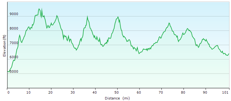
Distance in Miles
Miles of Trail
Minimum Elevation in Ft
Maximum Elevation in Ft
Interactive Maps To See Detailed Route. (Full Screen) Download GRIT3-SLoop Tracks
Legend
- Navy Blue: Designated motorcycle trails or notably tougher ATV trails
- Green: Designated ATV trails or just too easy motorcycle trails
- Red: Advanced Difficulty Trails
- Magenta: Roads. Dirt Road most often, but occasionally paved.
- Light Blue: Easier Bypass Detours or optional side-trips. Only the first section of a detour is color coded when the route splits.
- Black: Special Test Detours. Only the first section of a detour is color coded when the route splits.
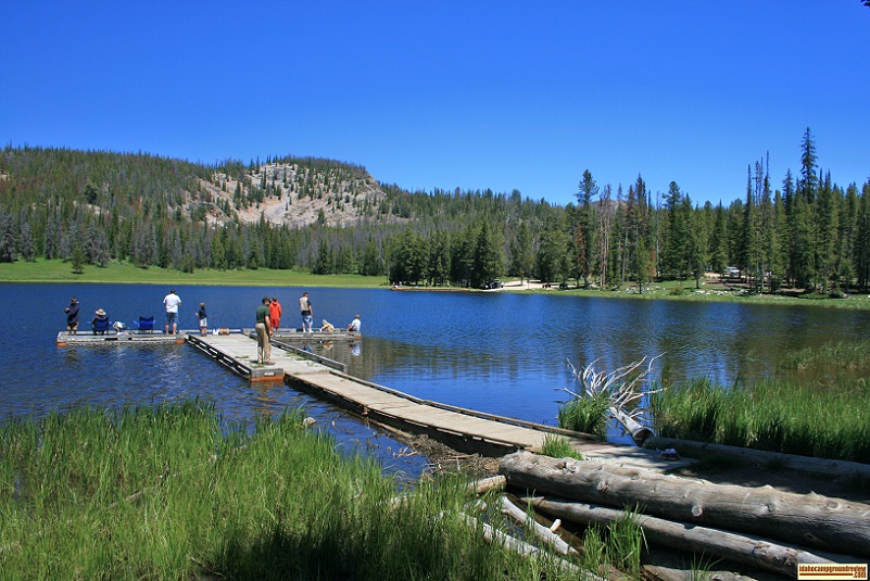 We head out of Challis to access some of the most spectacular high-country trails in America, if you have the skills and stamina to reach them. We warm up on Lombard trail to jam over some access roads and ATV trails to the top of Ramshorn Mountain at 9600ft. We cruise back down the mountain road to Little Bayhorse Lake for a relaxing rest scene and make a note to come back to camp someday. We now have the first choice of a special test for the trip. We can either continue down Bayhorse road to the rugged cow trail Juliette Creek or turn right to take Bayhorse Rd the other direction towards Trealor Creek trail, ATV350, and Squaw Creek trails. If you take Juliette Creek challenge then you will return back to Bayhorse Rd via Kannicinic Creek Rd, ATV Trail 4096 and Forest Service Rd 025. After Trealor Creek trail, ATV350, and Squaw Creek trails you will have your next decision – whether to take Peach Cinnibar or not. The moderate bypass trails of Marten and ElevenMile trails head north. But this is the Idaho 500 tough guy loop so the main route does not take these. If you have the skill and stamina to take on the advanced workout of Peach-Cinnabar trail, we head south on Squaw Creek Rd.
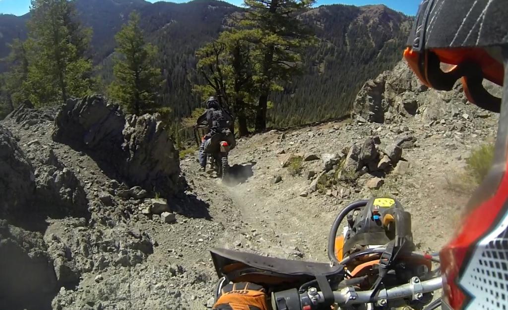
Cinnabar Ridge
At the top of Peach-Cinnabar, there is a spur to Custer Lookout. This same lookout is accessible on Stage 5 on our way back to Challis and you will naturally pass it If you do the Razor’s Edge special test, so we recommend you visit this lookout on stage 5. At this same point is the branch off to take Ramey Creek special test that includes sketchy sidehill if you didn’t think you are getting enough with the long day still ahead. The main route heads down Fivemile trail to rejoin with the bypass option loop.
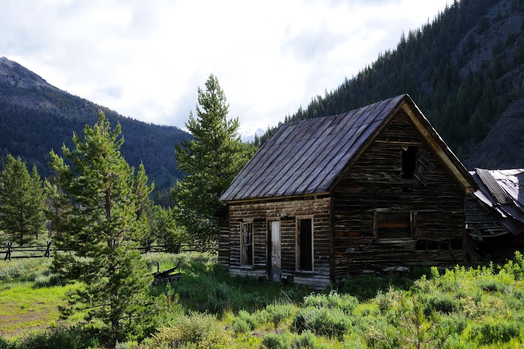
Bonanza Ghost Town
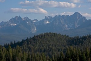
Sawtooth Mts from Trail 811
If you didn’t take Peach-Cinnabar, the moderate main route heads over Marten Creek Trail, aka Elevenmile Trail, and the scenic Eightmile ATV trail, past Estes Mountain mining area and down Jordan Creek Road to the Bonanza Ghost Town.
No matter how you got to Bonanza, it is worthwhile to stop and check out the cabins and Yankee Fork Gold Dredge before you start the next trail. After the break in Bonanza, you are ready to hop onto a 29 mile single track combination that starts with West Fork Yankee Fork, then Basin Creek before looping back on Trail 4038, Sunday Creek, and Little Basin Creek. There are bypass roads in here to cut out the mileage if you are having trouble. All options land on the Joe’s Gulch Loop Road for a picturesque ride into Stanley for the night. Note that the lodging waypoints in the GPX files contain some recommended motel phone numbers and websites to make reservations, and you will also have the info on your GPS for reservation changes.