R’Idaho Stage 1. RADS “Lost In…” Idaho ride.
After riding another Idaho route last year, I’ve been looking forward to doing something like that, or better this year. Someone told me about the “R’Idaho” route ( https://ridaho.info/ ) put together by Joe Smith. The ride goes from the southern border of Idaho and Nevada all the way up to the Canadian border. Better yet, the R’Idaho route has way more miles of single track trails through the most remote parts of Idaho.
We prepped the bikes and ourselves for an epic seven days of riding. Kevin Daniels who rode with me last year, Jesse Beck and I were the team.We picked up Kevin in Redlands where he was working on Friday mid day and hit the road. Gridlock traffic made getting out of town the first obstacle. 780 miles later we pulled off the highway and down a dirt road about five miles south of Jackpot to camp and crawled into our sleeping bags about 1:00 am.
Saturday morning came quick. We had some breakfast in the Four Jacks restaurant. The owner suggested we park right there in front. One issue resolved just that easily.
It took a couple of hours to get our act together and saddle up. We rolled out of Jackpot about 8:45 am PST.
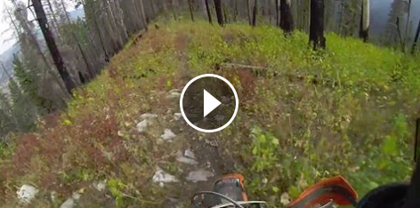
Dirt roads take us out to the mountains where we hit the first of many single track trails. The dry dusty conditions had us spaced out to avoid eating too much dust. On one of the quad trails Kevin had an awkward foot plant that jammed his knee. He carried on to the end of the day but it was clear that the knee was angry and sore, not ideal for an extended ride. I’m sure he would carried on if it had happened near the end of the trip.
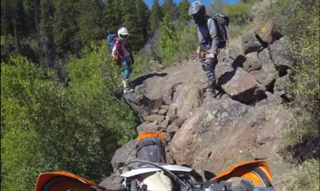
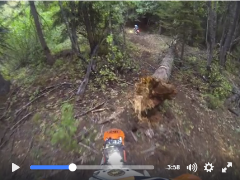
The first special test, Trapper Creek trails had the rock steps section that required a bit of pushing but we got through in short order. The second trail section was long and fun. Finally rolling out to the highway.
The desert section north of the interstate was entertaining. Dry grass covered two track winding through the lava, along power lines, through the small town of Gooding for a late lunch at the super market. Looking at the mileage we still had a long way to go.
More meandering desert two tracks and we finally were getting into the foothills. This day like all the rest would be was a long day. We finally rolled into the little mountain town of Pine just at dark. Gas and snacks at the store then the search for the hot springs. We camped just across the road from the Paradise Hot Springs resort.
Day one done and fun. 244 miles. A long way for a day’s ride.
Day 1 pics:

Sunset in Central Nevada.

Ready to ride

My bike, still fresh and ready.

The loose single track hill climb.

The rock steps


The long single track down Harrington Fork.
Perfect southern Idaho single track down Harrington Canyon

Desert two track some where in the middle of nowhere.

Kevin the flower child

Lots of gates

The foothills in the distance promise mountain trail tomorrow.

Looking like refugees.

Minimalist camping.
R’Idaho Stage 2.
Sunday morning we woke up on the banks of the South Fork of the Boise River. Kevin had agonized all night about his sore knee and the wisdom of trying to ride on. He’s not a quitter so the decision to pull out of the ride was difficult. In hind sight it was the right choice.
Jesse and I felt bad riding off leaving Kevin behind but he is a big boy, so we weren’t worried about him figuring out how to get home.
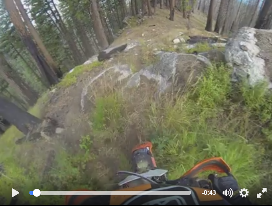
The day’s route was loaded with many miles of single track. Jesse and I had to get going. Out of 175 miles there was something like 60 miles of single track to ride, 30 or 40 miles of quad trails, one big river crossing and who knew what other surprises. It felt like we were riding single track all day. Long stretches of trail with some quick miles of connector roads then right back onto more single track. Every trail had its own character, all were fun and challenging.
We took a side route to the top of Iron Mountain to see the views and the lookout tower there. Jesse in a rare moment of distraction clipped a rock with his foot peg and got highsided off the road falling down about 6″ into a pile of rocks. I ran over to help him get the upside down bike back up but he was holding his hands in a bad way. He had managed to split and blacken both thumbnails, I thought he might have a broken hand, but if it was it didn’t stop him from riding albeit in pain for the rest of the trip. That was a reminder that it can all go wrong in a split second.
We had heard stories of the Snowline trail that is primitive and steep. Dropping down to the rather large river Middle Fork of the Boise River. We could see the size of the river as we picked our way down the steep ridge line. At the bottom we had to look hard to find the best line across. Jesse pretty much just went for it. After watching him make it to the other side I had to go for it. I picked my way across trying to keep my feet planted on either side of the bike moving forward one rock at a time. It was deep and a long way across. Slowly but surely I made the other side. A big relief. A quick lunch stop next to the river and we carried on.
Farther along the way we rode the Barber Flats Trail which had a few trees down some we had to go over, or under and we ended up cutting one. Some more dirt road along the river to the Haga Creek trail. That trail had some impressive exposure traversing the slope high above the river. We were closing in on that day’s end point in Idaho City. The fast flowing trail at the top of Haga Creek seemed to go on forever. Once we hit the fire road we knew we had that days ride in the bag. Side by side flat tracking mile after mile down the smooth slippery road was fun and entertaining. Idaho City is a little mountain town. The Gold Mine restaurant turned out to be a good choice, they have a nice varied menu. We headed on down the road to get a head start on the next day’s ride, finally camping on a forested hilltop above Garden Valley. 175 miles riding from 6:30 to 8:15.

My bike and bed.


Iron mountain

Jesse enjoying the ride


Miles of single track
A section of the seldom used Snowline Trail.

Looking down towards the river form high on the Snowline Trail.

Contemplating the crossing

Daunting view…

Jesse showing me how it’s done

Slow but sure for was the way to do it for me.


The Silky Big Boy made short work of this down tree.

Haga Trail Exposure


Long ways down

Some times over, this time under.


Nice camp site at the end of a long day.
R’Idaho, Stage 3 of 7
The third day was always going to be long with the added need to get to Burgdorf before they closed the gas pump and hot springs pool. Since we had gotten a head start after riding an extra 20 miles the day before we were hopeful we could make it. So far each days ride had taken longer than one would have hoped. With all the single track I figured that stage 3 would be no exception. My notes said 190 miles from the Garden Valley gas stop to Burgdorf, maybe 80 or 90 miles of single track. We got a decently early start rolling into Garden Valley for gas and back out onto the route. That morning the air was full of smoke. There were fire crews and trucks out and about. A ways out of town we got to the first of many sections of single track. Nice way to start the day. Up and over the Habit trail, then up the fun and challenging Bitter creek trail with its steep technical uphill’s. Do stop for anything or you’ve have a hard time getting going again. After cresting the pass a tight long downhill to a trail head for trail 044 and 590. 044 is a fast flowing trail recently buffed out with excavators. 590 ends with a steep quad trail down the ridge towards Warm Lake.
We stopped for some lunch overlooking Warm Lake then carried on headed for the Bear Riordan trail. Based on Joe’s info we expedited there skipping McClure. In hind sight that was a good idea because we barely made the gas in Burgdorf at the end of the day. It would have been nice to get those two trails we missed but too late now.
Bear Riodan was primitive and at times hard to follow. We like that though. The hill climb was tricky and steep. Crossing over the top we followed rock cairns and the GPS. Then the trail dropped down a steep, narrow, off camber, exposed slope. I had my moment not far down that section. Something flipped by back wheel off the trail and I had a nasty high side tumbling down the hill. The bike did one flip and stopped 8 feet below the trail. I went 20” down. I was basically unhurt except for my little finger which while not painful still doesn’t function correctly. It took the two of us ten minutes just to get the bike eight feet back up to the trail. The rest of the trail was just as steep and tight. At the bottom the trail tees into the Trail 097.
Down 097 to a road and on to Yellow Pine for gas and snacks. A big group of ADV types were strutting around getting fuel. Speaking to the leader he assumed we were on the Idaho BDR like they were. When I said that we were following another route with single track and remote trails he sort of dismissed our ride as less than theirs. I don’t think he knew what single track trail is.. The one guy wanted to know about the service intervals on our bikes. He thought that our bikes must have 10 hour service intervals, he had picked his bike based on long service intervals just to avoid that issue. He was riding a BMW.. I had to chuckle. Nice guys though.
We headed down the road looking for the side trip up the Fish Creek Trail. That is another trail with some exposure above a river eventually climbing up to the Trail 087 a fast single track with lots of big water bars to slow one down. Another trail with its own character.
Some road miles through some beautiful mountains to the Duck Lake trail. Yet another spectacular trail through some spectacular scenery.
By now it was getting late in the afternoon. I had hoped to ride the Victor Creek Trail for some bonus trail miles but there wasn’t enough time. So we followed the still great route on the Bear Pete to Nethker trail down into Burgdorf with 30 minutes to spare.
The very nice people at Burgdorf set us up with a cabin, towels, hot water and fuel. Perfect! We had a nice soak in the hot pool, then camped out in the cabin for the night. I say camping since there are no blankets or other amenities one would typically expect. We loved it!
Day 3 was yet another fantastic ride. As more days went by we were amazed by the quality of the route and the way it connects the best longest sections of single track in Idaho. Thanks Joe.

The rising sun looked like fire through the smoke and trees

Our campsite

Creek crossing

Bitter Creek
Part of the very fun Bitter Creek Trail

The top of Bitter Creek trail

Damaged bridge

The quad trail downhill trail

Bear Riodan
The start of the Bear Riodan downhill. Not my best moment.

DOH


Gas in the middle of nowhere. Always a good thing.


Fitsum Creek narrow trail

River view


Room with a view

Hot water!

The cabin they call “Mary”
R’Idaho Stage 4
Since every day had been different then the last we figured today would bring new challenges, vistas, unique trails, route finding, risks and rewards. With the fire closures in Lowman we would have to follow the reroute through Kooskia and Pierce. Not to worry there was still plenty of single track. Right out of Burgdorf we back tracked a bit up the Nethker trail to Bear Pete. Staying right we followed the long ridge line trail for miles of scenic views. After a couple of days of smoke filled skies this morning provided some clear air to see those views across the French Creek drainage to Lava Ridge. The Bear Pete trail is one of Idaho’s best. A must do for anyone riding in the Burgdorf area. Fairly Easy but a lot of fun.
Eventually we intersected with the Road between Burgdorf and French Creek. A long switchback descent winds down the slope towards the Salmon River. We saw a group of ADV bikes powering up the road as we coasted down. At the bottom we followed the river downstream past a riverside sand dune, down to the very cool wooden decked suspension bridge. There were two big cranes set up on both sides of the river, looked like they are going to replace the suspension bridge. I wonder if it will be as cool as that old bridge.
Joe provided a fantasy route as part of the Gun Club Fire reroute. The map showed the trail going straight up the steep slopes above the river. We spent a few minutes looking to see if we could find the trail and if so, would it be ride-able? All we could find was some evidence of a trail but no sign of any use. Just animal tracks. I knew better then to assume that the upper reaches of the trail if we could even find a way up would be full of downfall. We headed on down the road…
Since we had been out of cell phone range and or any internet connection we didn’t get the word that the Gun Club Fire closures were over. So we missed a section of trail across Chair Point that would have been nice to ride. We did get back on the route at Nut Basin. Trail 117 was a little used track across the top of the ridge. Fun to try and follow the GPS track and the rock cairns. At the split we took the west side route to the special test trails, Little Van Buren and No Business.
No Business trail going up Slate Creek
Little Van Buren dropped steeply off the ridge, narrow steep switchbacks. The GPS tracks were a bit different then what we found. No problem though. The trail popped out into the open connecting with the No Business trail. No Business turned out to be one of the highlight trails of the ride. Steep loamy switchbacks down through the lush ferns and forest. Crossing a road at the bottom then right back up Slate Creek on the other side. That trail climbed for miles following the drainage, lots of mellow side hill sections through the lush vegetation and deep forest. Very beautiful.
More Videos of No Business/Slate Creek
The single track ended onto a quad trail that dropped steeply down off the mountain crossing a paved road then down one of the steepest quad trail downhill I’ve ever seen. At the bottom we passed some campers and then were pleasantly surprised when the pink GPS track turned out to be single track! A fast easy trail that went all the way up to the start of the Marble Point trail. A fun trail through dark forests.
All too soon we were off single track for the day, a long road section through miles of private property took us up to a fun quad trail past Burnt Point. It was time to make some miles as we gradually wound our way out of the mountains into ranch land and the little town of Kooskia. We had a nice lunch at a great cafe with good food.
The next 50 miles was all about getting through ranch land on mostly dirt roads to Pierce. This was the theoretical end point of the day’s stage. Since we wanted to camp we headed back out on the trail after fueling up for the next gas in Avery of 190 miles away.
It wasn’t far out of Pierce to the first section of fun trail a ridge line. We came across a hunter in the middle of nowhere sitting by himself on an ice chest supposedly full of beer. Judging by the glazed eyes we figured he had finished most of them. It was getting late so we started looking for a camp site. I told Jesse to ride until he either got tired of riding or found a nice campsite, which ever came last.
We went in search of the special test trail Sylvan Ridge. It started out as quad trail as dusk became dark. Some searching was required to find the faint single track that dropped down through the woods to a road below. By now we had stopped and looked a several potential campsite, but each time we kept going. The trail headed up off the road into the dark forest. We asked ourselves if we wanted to tackle the trail in the dark. Jesse made some comment about wanting to ride single track in the dark with his new light, so up we went.
Didn’t take long to hit the first downfall, over that then another. I knew how this story was going to go, downfall this close together usually means the trail hasn’t been cleared in a while. There were no tracks or recent use that we could see. Three or four more logs some over some under, some sloped down threatening to slide the bikes into the darkness require some careful cooperation between us. I was getting hot and sweaty. I knew how this was going end. We’d be so committed that we wouldn’t want to turn back. Then we hit a really high log too high to get over, too low to go under. I was about to snap. We dragged my bike over but it wasn’t good, the bike took a beating. I was on one side Jesse on the other. Jesse said lets go back, I went from why are we doing this, too we’re going to do this no matter what. I looked up the trail, there were another 4 logs within 50 feet. Jesse started cutting the log between us I hiked up the trail to see how bad it was. Soon it started to rain. I came back and we decided to call it a night and camp in the middle of the trail. We set up the tarp and dug out a flat spot. The rain was intermittent so once camp was ready, I started sawing logs. An hours work and we had the trail cleared enough to ride through. A late night hike up the trail for a half mile gave us hope that we could get through.
Little did we know but Chris Miksovsky AKA Yellow Bear was literally just a few miles away having his own epic with his bike over the side of the trail.
That night Jesse kept asking why we didn’t bring bear spray. We were in the deepest darkest forest. Seemed like bear country. Finally after a very long day we fell asleep in the middle of a random trail in the middle of nowhere. It was awesome.

Bear Pete Trailhead

Lava Ridge in the distance


Modern day horse

River side sand dunes


The old wooden suspension bridge

Little Van Buren


No Business


So many bridges in remote places

Lush forest single track on Slate Creek

Open ranch land

Into the dark on the Sylvan trail.


Time to saw, Jesse’s bike on the wrong side of the tree

So glad we had the silky Big Boy saws

Camp. This was for sure our most epic day of the ride.
R’Idaho Stage 5
After four days on the trail we were feeling good and confident. Jesse’s hands hurt a bit but he was dealing with it OK. My hands were starting to hurt at night but it didn’t affect my riding. Barring some unforeseen circumstance the entirety of the ride was well within our abilities. . The rhythm of the ride and route is good. One day to the next there is a consistency that gives one confidence moving forward. Each day had some challenges but so far not unreasonable. The more I think about it the more I realize how well thought out the ride is.
Waking up on day 5 under the wet tarp required carefully getting out of our bags without getting wet. A small fire, hot water, oatmeal and coffee hit the spot and soon we were ready to see if we would be able to get through the next mile and a half of the Sylvan Trail. That is until I went to start my bike and nothing happened… As I usually do I had my music player charging overnight. I think I must have left it playing as well because charging that device had never run the battery down. We were in a place where there was no bump starting. I started kicking the bike. Right away I noticed the headlight flicker a bit so I knew that kicking the bike did provide some electricity. I disconnected my headlight and began to kick like I meant it, hoping to make enough power to run the fuel pump enough to get the bike started. It actually didn’t take long maybe twenty kicks and the bike sputtered, several more kicks and yahoo it was running. I was so relieved…
Putting my gear back on, (I had taken it off in anticipation of a kicking marathon). We rolled out of camp. Over the first two logs that we had cut but not sectioned past more logs that we had cut clear through, then into the ferns. It was hard to see the trail bed under all the foliage. A couple of times I would stray off the line a run into a log or rock I couldn’t see. Not really a problem just had to be careful. We had to spend 10 minutes clearing branches off a down tree that was parallel to the trail. Around that and then a big log with no way around. Out came the saws, we cut through it in about 5 minutes and carried on. We were almost to the road, literally 100 feet from the road was a huge downfall. No cutting that one but a bit of clearing brush and branches we were able to ride around the downhill side of the stump. Sylvan Trail had made us work for it, but just enough to make a good story, not so much to make us turn back or take too long.
Down the road we went, heading for the Larch Butte Trail soon enough we were rolling along the ridge over more logs then downhill. Deceivingly steep side hill drop offs covered in vegetation to lure the rider into not noticing the actual exposure. Narrow and fun, a couple of steep and sharp switchbacks. Off the bike, front brake, lean into the handlebars and rotate the back wheel around the corner. Sometimes it was possible to do it while still straddling the bike. Five miles or so and down across a deep rocky creek crossing. I looked across and there’s some guy with a camera out? If I drown my bike while that guy is taking pictures I’m going to be pissed. Jesse pinned it I picked my way across carefully. Didn’t fall for the Kodak courage. There were two guys with a truck and dirt bikes standing there looking at us like they knew and expected us. The one guy walks up to me and says “hi Dave, I’m Joe”, lo and behold it was Joe Smith and Yellow Bear Chris Miksovsky ! I was a bit surprised to say the least. What the hell was he doing all the way out here?
Then the story comes out, Chris had high sided off the trail, Joe had been watching his beacon and after not seeing him not move for 5 hours and embarked on a 7 hour road trip to see if Chris needed help. Chris had spent much of that time working with ropes and pulleys to pull his bike back up to the trail. It took him many hours into the night. Eventually he did get the bike back where it belonged and had camped out on the trail like we did. Funny we were camped not all that far away. Sounded like everything was good. Joe offered us a splash of gas. We were on a 190 mile section between gas stops. I learned long ago to never pass up gas in the middle of nowhere. We had five gallons each when we left Pierce and I’m sure we would have made it to Avery but gas is what makes everything possible on a dirt bike ride.
We hung out with Chris and Joe for a bit then headed on down the road. So cool that Joe would go above and beyond to make sure someone out on his route was OK. Thanks Joe.
Miles of single track lay ahead, first up the long and beautiful Weitas creek trail. Yet another great trail, I don’t even know how to explain the seemingly never ending single track after single track on the R’Idaho Grit 1 Route. 14 miles on the Weitas trail past the neat little Liz Cabin, then a section of quad trail that had big berm jumps every few hundred feet. Even when the trail was flat there would be these big kickers, not sure what the point is. Maybe to slow people down?
Joe had told us that there was a trail closure on Windy Bill for a controlled burn. We thought we were going to miss out on some great trail. But the work around route on the Cook Mountain trail was great as well. We were getting into healthier forests the farther north we went. Everything was green and lush. The Cook Mountain trail eventually brings us down to the North Fork Clearwater River to the Fourth of July Bridge, acool wooden suspension bridge. We took a nice lunch break in the middle of the bridge.
With more than 120 miles still to ride we didn’t hang out long, hitting the road, smooth wide gravel roads along the rivers are typical of the transfer sections of this ride. Usually Jesse and I would ride side by side on these roads. A short stagger formation paced to allow time to take evasive action when encountering oncoming traffic. It worked well for us. The dust was bad so even several minutes of separation often wasn’t enough time for the dust to clear.
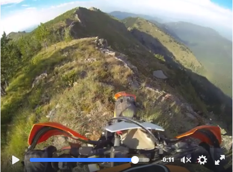
There was long transfer section to Cedars where a left and right turn puts us onto a more entertaining road. A bit rougher and narrower winding through the mountains headed for the State line trail. Our information was that the Simmons trails still had too much downfall to ride so we opted for the State Line Trail from the top of the pass overlooking Montana. I had ridden this section of trail last year and was looking forward to showing it to Jesse. Nice high mountain trail in an alpine setting with breathtaking overlooks. A couple of entertaining uphill’s and rocky sections across the ridge line with a couple of chances to get on top of a high point of the ridge overlooking cliffs and steep slopes with alpine lakes down below. Spectacular.
All too soon we popped out on the road. Miles of logging roads over and under some down trees to pavement. A brief stop on the side of the road to put on Jackets resulted in Jesse noticing that his back wheel was missing a spoke. No problem he said, I have a spoke. So helmets off tools out and then he realized there were three missing spokes? How the heck did that happen? The bike is fairly new, Jesse checked the spokes before the ride so why? We never did figure it out. The spoke he had wouldn’t thread into the spoke nipple so that was a bust. We decided we better carry on to Avery and hope.
Twenty five miles of paved road alongside the river into Avery. Just outside of town Jesse saw another bear. We noticed a motorcycle behind us a ways as we pulled into town. First things first we looked for gas. We missed the gas pump at the store but found the gas pumps at the end of town. Jesse thought that the motorcycle we saw might have been Chris Miksovsky. Turns out it was though we didn’t see him while in Avery, he thought we had just kept going so he took the road to Wallace.
In Avery we had what could be barely be described as a hamburger. There was a mystery meat patty and a cheap bun but nothing else. Should have just cooked our own food. We bought some water and headed back out.
A short backtrack out of town then a blue line on the GPS. It took a minute to see the trail in the dark. Up we went. In hind sight it might have been a bit risky. I couldn’t really see it but I could sense the drop offs. In the dark the loose rocks made it feel less then easy. But once you start you don’t want to stop. As we climbed higher the trail got a bit easier. Time to start looking for a camp site. Once again I told Jesse, ride until you’re tired of riding or until you find a cool campsite, whichever comes last. We ended up riding the whole section of single track and some quad trail until we dropped back down to the main roads. A short distance along the route we went through the three tunnels. Right after the tunnels we took a side road across a bridge and found a nice camp spot right next to the creek.
It had been a long day. Jesse was really worried about his wheel, I was tired, it was late but we had had a great ride that day. It was all good. We discussed the wheel, no more spokes had broken since we last looked. None of the remaining spokes seemed loose so we spent the time to get out bailing wire and tied all the spokes up hoping to keep from losing anymore. There were still two days to ride so at that point we had a lot of doubt about that wheel making it the rest of the way. We thought we might have a chance to find some spokes in Wallace the next day so with that hope we hit the sleeping bags yet again.

Early morning ritual

Camp in the deep woods middle of the trail.

Everything damp.


Joe Smith and Chris discussion where he should go after the ordeal of the day before

Chance meeting of R’Idaho folks out on the trail

More perfect single track

Notice the gas bag on the back of the backpack.

High above the creek

Liz cabin

Yellow flowers forever.

Another cool bridge

Nice lunch spot

High Alpine single track, state Line Trail


Amazing views

Another amazing view from the State Line Trail


The crest
High on Stateline-video


Night riding on Nelson Ridge Trail,

One of the Moon Pass Tunnels
R”Idaho Stage 6
Ride, eat, ride, sleep, ride, eat, ride, sleep. Repeat 7 times and if nothing goes wrong you might make the northern border.
By now we were pretty used to that routine, get up at first light, make a small fire, hot water for oatmeal and coffee, give the bikes a once over, load the packs, start the bikes and head out on the trail for another 12+ hours of riding. Riding is what the Grit is all about. No time to dawdle, no time to sightsee, just ride and keep riding. This is why we were on this ride.
We rolled out of camp after changing out the air filter skins and checking Jesse’s spoke. More bailing wire tying the spokes together. Will it last another two days?
A short way up the road and let the fun began. Yahoo a black trail, extra credit to start the day. Why is it so much easier to jump on the extra credit first thing in the day? The Wonderful Peak Trail, was wonderful. Switch backing up the mountain climbing higher and higher to the high alpine slopes across Wonderful Peak and Stevens Peak. Long traverses across wide open slopes until we hit a quad trail going straight up the hill to the top of Steven Peak. Fantastic views into Montana.
A long jeep trail winding down off the mountain back into the river valley. A few miles of road and we roll into the cool old town of Wallace. We were hungry and went looking for a place to eat. A nice Saloon on the east side of town looked good. The food was even better then it looked. We’re about half done when Chris Miksovsky walks in. He had spent the night in Wallace and had seen our bikes. We had a nice chat that got around to the missing spokes on Jesse’s wheel. I called Joe to see if he had the phone number of a local rider who had offered help to anyone passing through on the R’Idaho. Joe picked up but didn’t have the number handy. Later after we headed on out he did make contact with the local but by then we were out of cell phone range. Thanks Joe for trying to help out. So many good vibes in the R’Idaho community.
Heading out of town a long transfer section takes us to more sections of the State Line trail system. Once again we were treated to great R’Idaho trail riding across ridgelines and mountain tops. Fun talus slope traversing trails a couple of down trees made for a spectacular ride. Somehow we missed the extra credit trail up to Granite Peak. I guess we were just moving along to much to notice the black line on the GPS. A bit of quad trail and a switch backing jeep road took us back off the mountain. A short paved transfer section and right back on the State Line trail!
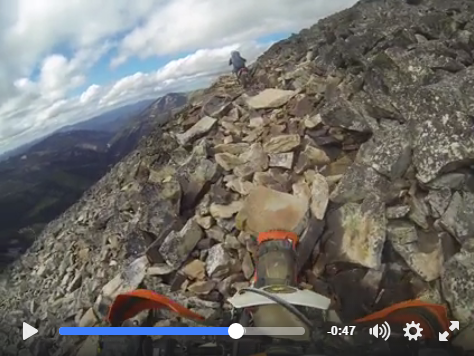
More great trail riding, more talus slope traverses with very cool rock garden sections. Lots of great views to the north east looking in Montana. This was a nice long section of trail many miles and many smiles. So for we hadn’t noticed any change in the condition of Jesse’s wheel so we were starting to feel confident again. Eventually we were got on some scenic roads still crossing the mountain tops.
A long 42 mile transfer section complete with a short overgrown quad trail take us to another great trail, Independence Creek. This trail looks like it get lots of use, fast flowing with some whoops, creek crossings, bermed up corners through the trees and several intersections with other trails that looked good as well. Someday I’ll have to get back up there and ride that whole network. We saw some beaver working on their dam, all in all a nice trail. All too soon we hit the west end trail head.
By now it was getting into the late afternoon. We headed right on by the Gold Creek Lodge where the days stage theoretically ended. We had already planned to continue to Clark Fork so on we went.
One last section of trail was also one of the most unique on the trip. The Gold Creek trail through the old growth cedar forest. So beautiful even though the silt was bad.
On the way down into Clark Fork we decided to pass up the out and back Green Mountain special test trail. This was the first special test we knowingly past up. With one day left and Jesse’s wheel issue and the late afternoon we wimped out. By the time we got into Clark Fork the sunset skies reflecting off all the water in that valley was some consolation. In town it looked like everything was closing down for the day, but we found a nice cute restaurant with a great menu and nice friendly ladies waiting on us. Perfect timing once again. Since there was rain in the overnight forecast we opted for a room at the lodge. After 6 days on the trail a 7 days since a real shower and all but one night sleeping on the ground that shower felt real good. It was starting to feel like the end was in sight. Almost too soon. That night it rained. We were glad to be inside…

The morning routine packing up camp

Long open slope traverses

Hard to see the trail

Nice high point views


Hunting season dog jacket.

Many sections of talus

More of the amazing State Line Trail near Black Peak

Lake views

More rocks

Big open talus field


Ridge top trail


Looking back

Overgrown quad trail

Sleek beaver


The Cedar forest


Water everywhere

R’Idaho Stage 7!
Canadian Border here we come! A more leisurely wake up this morning since the curtains are closed and its dark and rainy outside. The parking lot is all puddles with rain drops splashing down. No reason to rush, right? Well even though the last day was supposedly only 125 miles we knew better. The coffee pot in the room made nice hot water for our breakfast routine. Reluctantly we geared up. Why is it hard to start out in the rain? I looked at the weather radar, green right over us but it looked like it would be backing off soon. That was good enough so out into the rain we went.
Jesse’s wheel was still the same, so that was good news. We headed out of town in a light drizzle. Mostly paved roads through residential and farm areas. Thirty minutes and we gassed up at the highway crossing. That turned into a 20 minute debacle, the internet was down, and everyone was pressuring the teller to sell them gas. Finally we elbowed our way to the front of the line and payed cash, then we had to go back and get change. Oh well, off we went.
A ways up the road we finally get to the first trails of the day. A deep water crossing, maybe the deepest of the trip to a freshly graded quad trail. Grading is not really what they did, more like torn up, it was basically deep sand/dirt with rocks. Fun though! Up this trail we went to the first single track of the day.
The White Mountain trail was yet another great trail. Different than the rest. Upthe special test section to White Mountain on a rougher trail. The Forest Service is in the process of rerouting that trail so we had the pleasure of riding brand new virgin trail. Some of the reroute was incomplete so that made for a couple of interesting sections. The trails ends on a high point where it looks like there might have been a lookout tower or something in the past. A couple of pictures and back we went. We thoroughly enjoyed that trail, so fun.
After another scenic high point we were back on roads. Somehow we missed the quad trail since we were following a pink line on the GPS. We had to back track to get back on course. That was a fun trail, a rough, rocky, twisty and long section of trail across the mountain heading for the Roman Nose area. A quick trip up the road to see the lake and back down we went heading for Bonners Ferry.
We stopped for lunch and a brewery right there as we came into town. I wanted to make some phone calls to set up a U-Haul. There was a wedding party going on so it was crowded but everyone was real nice. Had a long chat with the bride’s father. We could tell by looking at us, and I’m sure smelling us that we had been on an adventure. He was stoked to hear what we had been doing for the last 7 days.
The U-Haul people booked me a very expensive truck. It was just down the road so after lunch we rode over there to complete the arrangements. I didn’t want to deal with it later in the evening. Last year we had epic getting a truck so I wanted to get it squared away asap.
Keys in hand we headed back out on the final leg of the trip. Some pavement then some roads took us back out into the forest. Joe had given us a reroute for what I remembered as a fire or something like that, so when we got to that decision point we figured we’d go for it. All someone could do was turn us back. Well we found out that the trail itself has been destroyed. We attempted to ride up it anyway but it was pretty clear that the trail was done. So we turned around and headed back for the reroute.
Some roads took us to the quad trail that has the reputation of a steep hard climb. That turned out to be the case. Jesse made it up on his third attempt. I opted to try and zigzag through the forest off to the side looking for better traction. That wasn’t easy either. Some pushing and shoving were required for me to get up the hill…
At the top we hit single track. The Danquist Trail. As we headed down soon we were on brand new trail being rerouted with a backhoe, now it was a wide trail. I’m sure that in a few years it will feel like single track again. Across a road and out to the highway. I was parked in the middle of the dirt road looking at the GPS and the map to make sure we went the right way. This truck was coming down the road, looks like he’s slowing down, Looks like he’s going to turn in, I need to get out of the way but the truck just kept coming. Right about the time I thought I was going to get hit, the driver slides to a stop and its Joe Smith! How does he keep finding us like that?
We talked for a few minutes, he had come all the way up to see us finish. So cool. But we still had more riding to do so we agreed to meet at the East Port Border crossing once we finished.
A mile or two and right back onto the last single track of the ride. It was fitting that we were riding single track right to the very end. The R’Idaho Route is all about single track so it was a perfect way to end the ride.
The last trail, Mission Mountain was great as well. There were a dozen or so downed trees, some harder than others to get around but by now we didn’t even mind. Seven miles later and a short mile or so of dirt road and there was the border. Just the end of the road with a couple of logs across the footpath that disappeared into the big slash cut that is the international border. No one else around. A bunch of pictures later we headed back down the road
We were stoked to have finished while bummed that it was over already. Time to start the long trip home.
Not far down the road here comes the US Border Patrol. I guess their sensors had been triggered and someone had to come up and see who it was. A friendly but thorough chat with the agent was required before we could continue…
We needed gas so we stopped at the little store with the gas pump. Yet another epic getting gas. The person in front of us had put in only three gallons, but the sale total was $8300? It took 20 minutes for them to get that straight before we could get a couple gallons of fuel. Seems like gas is hard to come by up here in the north.
Down the highway we went, now we were starting the long trip back home. We had about 1500 miles to go. But we still took the time to go see the other border. Joe was waiting there for handshakes, smiles and pictures. So cool of him to care about the people who attempt his vision that is the R’Idaho.
We met down the road at the “traditional” place for dinner at the Fiest Creek Lodge. More smiles and lots of good food with Joe and the folks hanging out in the bar.
All too soon we headed back out into the dark in a light rain down the road yet again heading for our U-Haul. That last day of 125 miles turned out to be 195 once we got back to Bonners.
All told we rode exactly 1400 miles according to the GPS tracks. What a ride. I don’t really know how to sum it up but fantastic comes to mind.
Two days later we rolled back into dreary Southern California. Now after all that driving I was glad to be home. My hands hurt, and still hurt as I write this. But it was well worth the time and effort it takes to ride the R’Idaho.
Thanks Joe Smith.

Wet

Into the rain


Deeper then it looks

Where’s the front wheel?


Another great section of trail

White Mountain Trail

Top of White Mountain

Team RADS “Lost In…”

Clouds so low you can reach up and touch them

Roman Nose Lake


Quad trail challenge


Trail tools

Skinny

Last Trail

Mission Mountain trail

One more log

In the clouds

Trail down to visit the border

The end – Remote Canada Border


Team RADS got it done, Thanks Jesse for playing.

WTF

Picture time at the Eastport Border Crossing

All smiles at Feist Creek Resort


Our ride back to Jackpot.