Trip report: GRIT1 Exploration
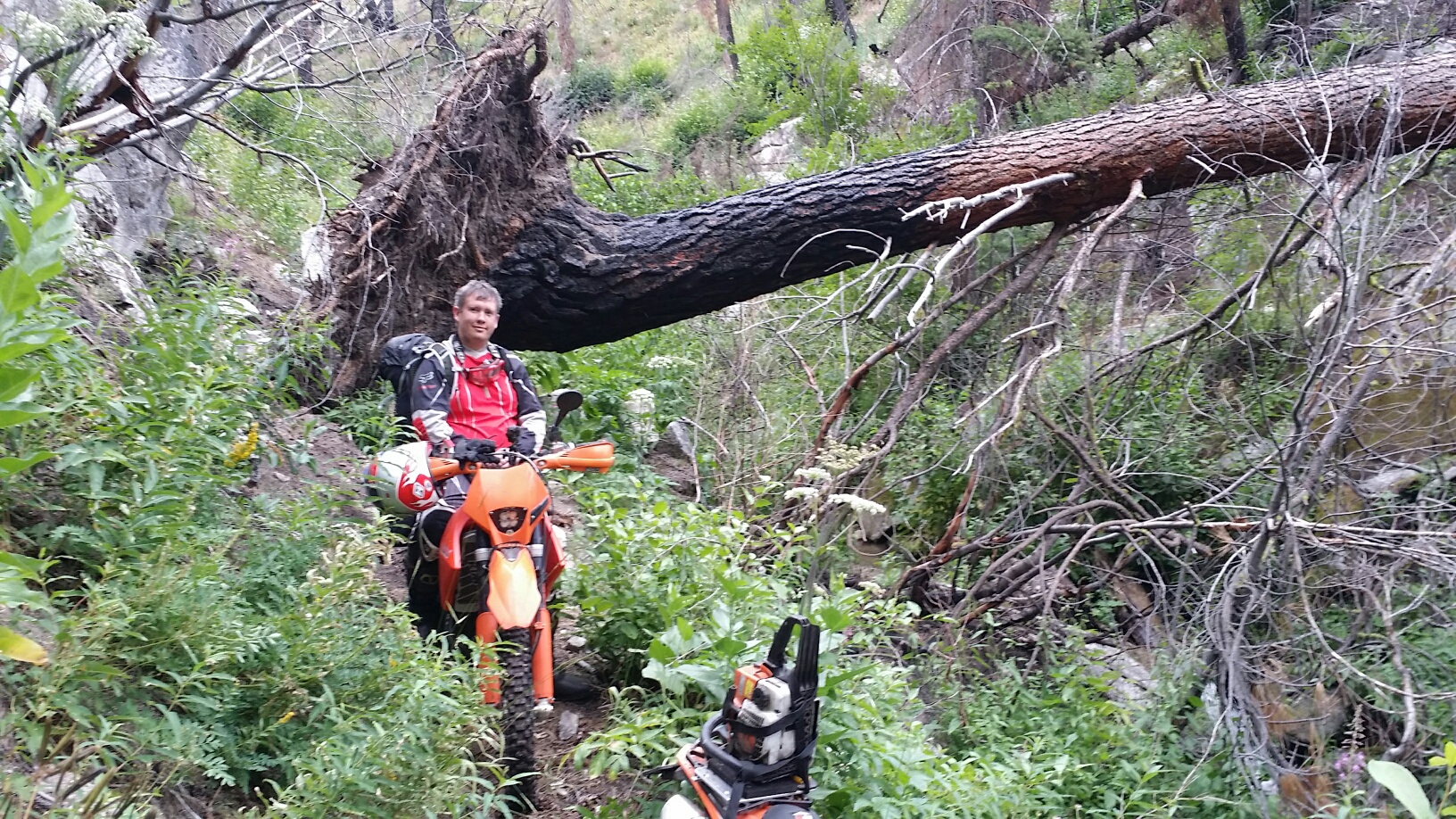
We had 4 days to explore 2 or 3 stages of the GRIT1, with bookend days of driving between Spokane and the Boise area at each end. On day one, we were almost got to Pine when we crossed the Stage 1 route as it comes out to the highway. That’s when I saw there was a road closed/no-trespassing sign. So we drove back into Glenn’s Ferry and explored and alternative route in the truck that was quite scenic and nice for dirt road riding with a few extra miles of slab than I had planned. I’ll put out an update to stage 1 with this fix. Then we drove the rest of planned Stage 1 up to the trail head of Camp creek for the only single track for the stage. We unloaded and asked our driver to meet us in Pine for the night taking the GRIT1 bypass road. We only had 15 miles of MVUM trail and a chainsaw so we thought we were ready.
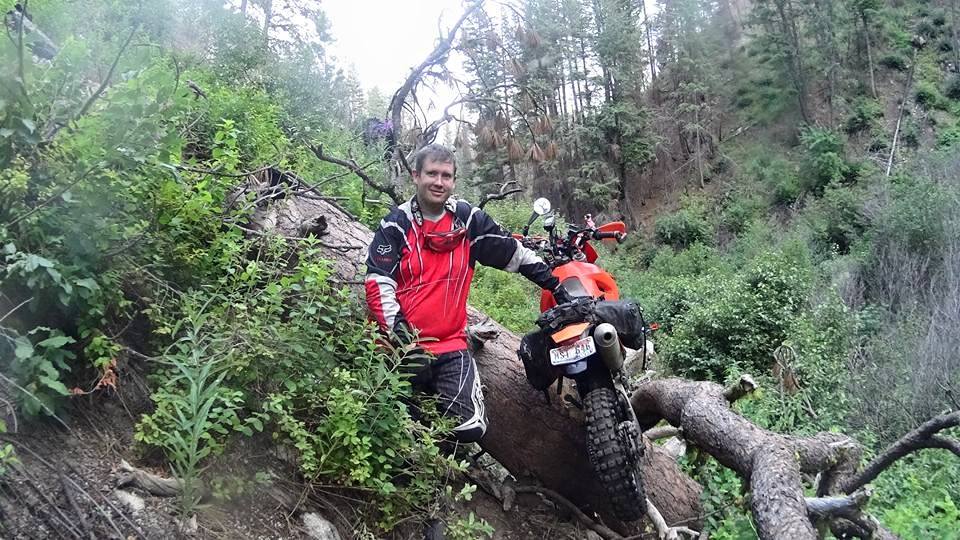
The 15 mile trail loop around to Pine is a combo of Camp Creek trail, a portion of Crosscut South trail, and then Green Creek trail back into Pine. Camp Creek was moderate, but somewhat bushy and overgrown in places. Crosscut South was good with switchbacks and a few trees that we cut out, discovering that my chainsaw was dull and not responding well to a file. There is a steep descent into Green Creek trail head but all fun. A worthwhile trail to add some fun after a long desert ride.
![]() – Camp Creek and Crosscut South Trail Video
– Camp Creek and Crosscut South Trail Video
 Then we head down into Green Creek trail which became a narrow canyon with steep sides with a tumbling stream bed at the bottom. We encountered a few trees that were too big to cut, so we had to lift or go around in the root ball hole that was exposed when it fell over.
 On this one, we had to use the strap we carried to restrain the back wheel and keep the bike from falling head over heals on the downside which was a good 5 foot drop.
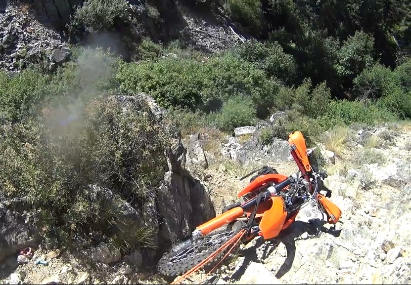
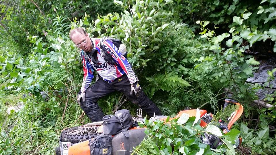 At times, the trail had a near vertical drop off into the stream 6 feet below, with a very narrow and often off-camber riding surface. We managed to drop one bike down off the trail with no chance of using my self rescue pulley with only bushes to tie to. I’m standing vertical in the pic, so if you tilt your head you get a better idea how steep the bank is. So we used the strap to allow one rider to pull up from the trail and the other to push from below. Huffing and puffing, we got back up to the trail.
Then we ran into a section where the trail took you directly into the jagged rock stream bed which proceeded to go over a 3 feet vertical waterfall with too deep of a pool at the bottom. We pushed our way around the waterfall thru the bushes without mishap except for more fatigue. Soon after, the trail got much better, and there were fresh trail market ribbons and logs cut. It was less than a mile of bad trail that caused all the problems. It appears this trail is in process of restoration and it needs it. The near term GRIT1 fix is to take the bypass road into Pine to miss out on all these trail, or continue up Crosscut South and take the Trinity road back down to Pine. I’ll release a fix soon unless I hear from the trail coordinator that they will get the green creek trail fixed soon.
We start the next day with the hope of riding from Pine to Atlanta and meet up with our chase truck there to decide if we could press on to Lowman. A few miles out of town I noticed that I had mostly flat tire. On our way back to town, we met our truck on the road and did a tube change with my portable tire changing stand. We felt like we were in popular trail country now so we left the chainsaw in the truck. But after riding the Paradise ATV trail and connector road, we found the first single track on stage 2 (N Fork Deer Creek) was heavily blocked with tree fall so we took the pre-planned bypass available and got on Deer Creek Ridge ATV on our way to the highly rated Porcupine Ridge trail. These trails were what we came for…flowing scenic mountain trails.
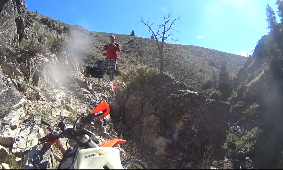
At the bottom of Porcupine Ridge, we start off on Slickear for bit then take the east/west portion of N Fork Lime Creek trail 44. But the place where trail 44 was supposed to split off from slickear had no signs of a trail. I walked around the gully and hills for an hour and re-checked all my maps. I knew that the 3.6 mile connector was important to get to the popular Presidents trail from the excellent Porcupine we just rode. But I had to give up, so we headed up Slickear that ends right back near the beginning of Porcupine. But not far up the hill, we found a clear trail going directly where the trail 44 was mapped to go. So being the brave men we are, we took it. Verily, it did go right towards where trail 44 was marked on the map down a long, steep, loose, rocky hill that i figured would be a push and scratch ordeal to get back up. Then it roughly paralleled the mapped trail 44 so I was hopeful. But it was difficult to follow at times and had steep side-hills with some washouts to overcome. If you left the trail on the side-hill, traction was useless and you were just dragging your bike back up to the trail. We struggled, fell, and walked ahead looking for the faded trail until too much time and fatigue had been dealt. Here is a couple video clips I took along the way but I was usually too distracted with my Joe Average riding skills on these challenges to take pics.
![]() – North Fork Lime Creek Trail 44 Video
– North Fork Lime Creek Trail 44 Video
We pressed on down this trail that was less than 4 miles long, not wanting to go back thru the difficulties we had just overcome. Walking would have been much faster than our riding progress. Then it started to get dark. At that point, we saw that we were only about a half mile from where the trail comes out. But then we hit the toughest obstacle of the day with the most consequence for failure. It was a 2-3 foot ledge rock climb along a steep side-hill with a turn uphill and loose dirt approaching it. If you failed to get up and rolled backwards, you would go directly down the steep loose hill where rocks did not stop tumbling until they hit the river far below. That’s when were agreed it was time to walk to a more level camp site and spend the night. At that point, walking was a joyful and easy way to get somewhere without the danger and struggle. We found a very nice campsite on a river plateau, and built the sacred fire to dry our clothes, drenched with sweat. Two exhausted souls slept in their summer sleeping bags. Here is a view of where we stopped along the trail. Click on the image for full resolution viewing.
The next day we had to hike back in, find my helmet camera that had been stripped off by branches, and plan our attack on getting the bike to the end of this ordeal. We worked together using the self rescue pulley I carry and managed to get them over the ledge.
![]() – North Fork Lime Creek Ledge Ordeal Video
– North Fork Lime Creek Ledge Ordeal Video
We rode the last half mile in similar struggling fashion to how we had ridden the previous 3 miles. But difficulties were lightened by the hope that the end was near. We managed to get out with no damage except a lost air box cover/panel. It will be an ordeal that we will speak of fondly now that we are back to a place of tranquility.
The road we found took us back to Pine. We ate as much food as we could, checked back into the same motel and napped, refusing to make any more plans to ride. We had regularly reported our situation to our truck driver using inReach so he had been having his own tourist adventures in the truck…. swimming in Baumgartner hot springs and learning about the people and history of Atlanta, Pine and Idaho City. All was well. While we rested that afternoon, we even found a bypass road with easy access to both Porcupine and Presidents trail , so the only trail we will lose is the bad 4 mile section of N.Fork Lime Creek.
The final day started with re-mounting the chain-saw and clearing the North Fork Deer Creek trail that had turned us around early two day ago. It felt productive and the trail was cool. But we found that the return loop trail, Lupine Gulch was non-existent and this was a dead end. The bypass road we took on day 2 will have to be permanent. So we went back to Featherville, ate lunch with our driver and decided that the highest risk/unknown trail left on stage two was the final one, Grand Mountain. So we loaded up the bikes and headed to the trail head together for our last exploration. We discovered that Grand Mountain trail ranks up there in the class of National Recreational Trails.
It was a flowing ridge top single track with awesome views. It had 4-5 trees down that we sawed out so we did some good while we were there. That was satisfying, but the real payback was that we ended our exploration journey with a thrilling highlight that made the struggles seem distant.
Overall, it was a productive battle that had me down at times, so I had to keep in mind that…

Awesome write up. And, it was exciting to watch your progress on the Delorme InReach website. I had lots of questions from watching the progress points which the write up has answered. With all the fires that have plagued the Baumgartner area the past few years blow-down will be an issue for years to come. I enjoyed the pictures and videos as well. Only wish I was there with you all to help out. But, this whole year will end up being a sideline year for me.
Ьookmarked!!, I love your web site!